My original plan for today was to head back up through Boulder to Torrey and do some hiking in Capitol Reef. But after driving to/from Boulder 3 times yesterday, knowing it's over 2 hours to Capitol Reef and they will be crowds (the hotels are sold out) today, the winds are just an excuse not to drive there. I accomplished what I wanted to this trip which was seeing Calf Creek Falls so anything more is just icing on the cake (so to speak). So I'm heading home.
I actually get going around 7:30am. I'm just heading straight home so I pass an empty Mossy Cave parking (even though the sun is shining so nicely on the rock formations) and head up the hill towards Bryce Canyon.
But as I roll up on the Bryce turnoff, I notice something else with the large steers on the south side of the road, Pronghorn!!!! I turn around (at the Bryce turn-off) and pull off the side of the road. There are at least 4 of them still bedded down. Very cool!!
Well that gets me a bit motivated so since I'm already facing in the direction of Mossy Cave....why not?!
So I head back east to Mossy Cave (and the parking lot is still empty - yea!).
It's a bit cool this morning - upper 40s. But the sun is shining and the rock formations are wonderful. The creek that the trail follows still flowing at a pretty good clip (probably coming from the upper parts of Bryce which are over 8000ft).
I've been here a few times before -- the cave is the big draw (large icicles in the winter and dripping mossy cave otherwise) but the scenery is a can't miss as well.
I'm seeing a couple of yellow flowers this morning.
I follow the trail to the first bridge.
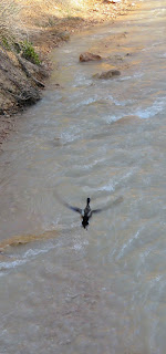
There's a lone male Mallard down there.
And he soon flies.
I continue onto the 2nd bridge. And after crossing, get my first view of the waterfall.
I reach the intersection - left goes to Mossy Cave; right goes to the waterfall - and I head right. It's just a short walk before I'm at the waterfall. And then behind the waterfall.
Time to head to Mossy Cave. (Still think it looks better in the winter.)
Glad I stopped!!
I head back to Bryce; the pronghorn are still there but they are standing now.
A few miles down the road, I see 2 more Pronghorn standing 100 ft off the road looking at the cars (hope they time the crossing properly).
I'm heading for a short stop at Red Canyon; the Arches Trail specifically. I hiked this last March, hoping for more flowers in bloom.
If you're on HWY 12, you can't miss Rec Canyon as the road runs right thru the bright red rocks. I'm heading to the Losee Canyon Trailhead which is 2 miles down a dirt road on the west edge of Red Canyon. The trail is short -- only 0.8 miles starting at around 7000 ft and gains only 100 ft). If I remember right, there are bunches of little arches to find.
I make it to the parking area and start by crossing a dry wash before reaching the trail. The trail is both in the sun & shade. I head counter-clockwise and soon find an old kiln.
I quickly notice a low growing flower (and plenty of them - white and pink ones); looks like Phlox. They are all along the trail.
And a few yellow flowers too.
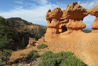
But the star is the scenery -- arches, faces, ....
I reach the 1/2 way point -- the "looking" eyes.
I peer through one of the windows.
Here I see my only butterfly -- a White --- but I can' get a good look at it.
And a pretty little bird.
Wonderful stop, but it's time to head home.
I drive HWY 12 to 89N. I should turn-off at the Beaver Exit as it will get me to the "quicker" I-15 sooner. But I decide to be different and continue taking 89 north to see what lies ahead. (And besides, I'm the only car on the road, the 5 cars in front of me turned towards Beaver.)
The road follows a creek the whole way. The first part was a wetland / ranch land -- beautifully green (many shades). Plenty of cows too. But along the way, I spot one Sandhill Crane in among the cattle.
There are mountains to the west -- some of the higher peaks still have snow on them.
But after Maryland (small town), the road enters a curvy canyon (stream still right next to the road). The rocks are some many different colors -- there are sections of yellow, red, brown and something that looks a little like purple. So glad I took this route. Highly recommend if you enjoy scenery (and have the time).
I finally reach I-70, head west to I-15 and then north. The only deer of the day was along the I-15 just before entering Nephi.
Wonderful day and trip!!


