Never been there before but it is supposed to be a good butterfly trail as it follows a stream through a mountainside valley. (Read that over 60 species of butterflies have been documented there. I'm just looking for one of them.
Actually never been in Provo Canyon either but the instructions mention Vivian Park which sounds very familiar to me but I don't know why.
Sunny morning today with temps in the mid-90s again! Not quite an early start because I want to make sure the sun is up high enough to get over mountains/foothills if they exist.
Pretty easy to get there - drive down I-15, exit UT-52 east and straight onto US-189 (Provo Canyon). I pass some places that seem to deserve a stop (like Bridal Veil Falls) but I'm going butterflying. (But will have to come back.)
Soon I realize that if I continue far enough, I'll be in Heber and I've been to Heber for the International Sheepdog Trials.
But here comes Vivian Park and my turn. And I realize why Vivian Park is familiar; it's because that was the destination of the Heber Creeper Train when my Dad, Uncle and I rode it a few years back. That was a fun day.
It's a short 3 miles drive up a very curvy (and beautiful) South Fork Canyon to my turn at the Big Springs Hollow park/trail. Very nice park and very big; I wasn't expecting that.
I drive to the end of the road which is a very large parking lot. Time to start the trail and search for the Tailed Copper.
I should note, I'm not quite sure what to expect on the trail. My book says its 5 mile (round trip) "lollipop" trail with a 550 ft elevation again. AllTrails, however, says its an out-n-back 4.2 mile trail with a gain of 1177 ft gain. Which is correct, I'll soon find out.
The trail starts with a footbridge crossing of a small stream. The stream I'll be following and listening to on the entire trail - a stream whose source is the mountain Spring.
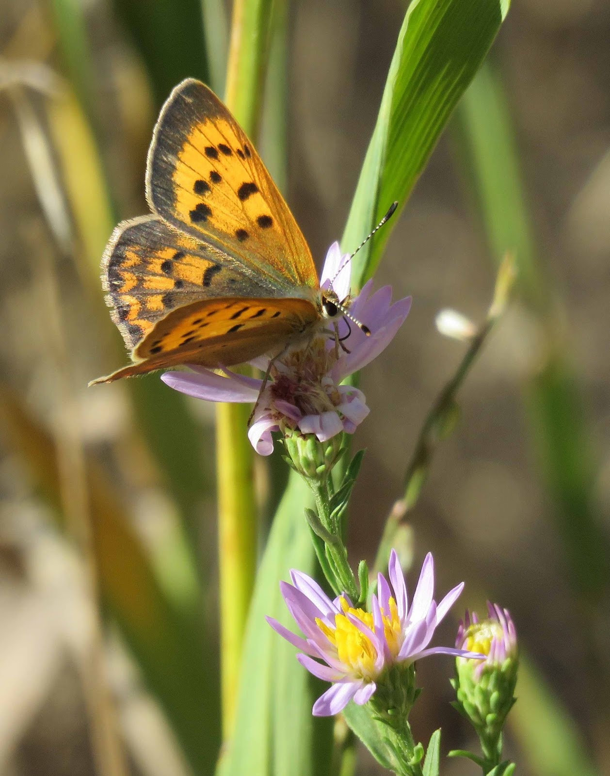
I pass several tents pitched along the stream as I pass through a very dry section of the trail. I'm immediately excited when I see a Copper flying. Could it be.......no, but a very fresh Purplish Copper.
The trail continues up the valley passing thru woods (aspen and maple) and various size meadows. It's green near the streams and drier in the larger meadows. (This must be a gorgeous trail earlier in the summer!)
The patches asters, yellow composites and goldenrod are spread along the trail.
I cross the stream several times and am gaining elevation -- the reported 550 ft gain can't be true.

In the one big meadow, I get a view of Cascade Peak in the distance.

Along the way, I see Woodland Skipper (tons of them),

a Red Admiral (haven't seen many of these this year),

Great Spangled Frits (quite beaten), and other unId Frits.
Soon I arrive at a little dam.

It's actually a good butterfly stop. I find Weidenmeyer's Admiral, Mylitta Crescents, Field Crescents,

Variegated Frit (1st on in Northern UT for me this season),

and a Hoary Comma.

It gets a little steeper now and the habitat transitions to more conifers. And then I'm there, the Springs.

Definitely not what I was expected.
I take a break and check the elevation, it's ~6700 ft -- AllTrails is correct - 1100 gain!
Time to head down. On the way I add a Painted Lady and Common Checkered Skippers to my list.
Nice hike! (I'll be back next butterfly season.)