The Mirror Lake highway is a scenic road that connects Kamas UT (6400 ft) with Evanston WY (6700ft). The road is curvy with plenty of great views along the way. And the hikes along the Mirror Lake highway are all starting at/over 10,000ft.
The Mirror Lake highway just opened on Monday June 5. (It always closes for the Winter.) I can't image that many of the hikes (or even parking areas) are snow-free just based on what the Wasatch Mountains look like but I'm heading up anyway!
First stop is the Provo River Falls. (6680ft). I've been here many times before and it's always fun. But I've never seen so much water coming over the Falls!! I can even feel the spray in the viewing area.
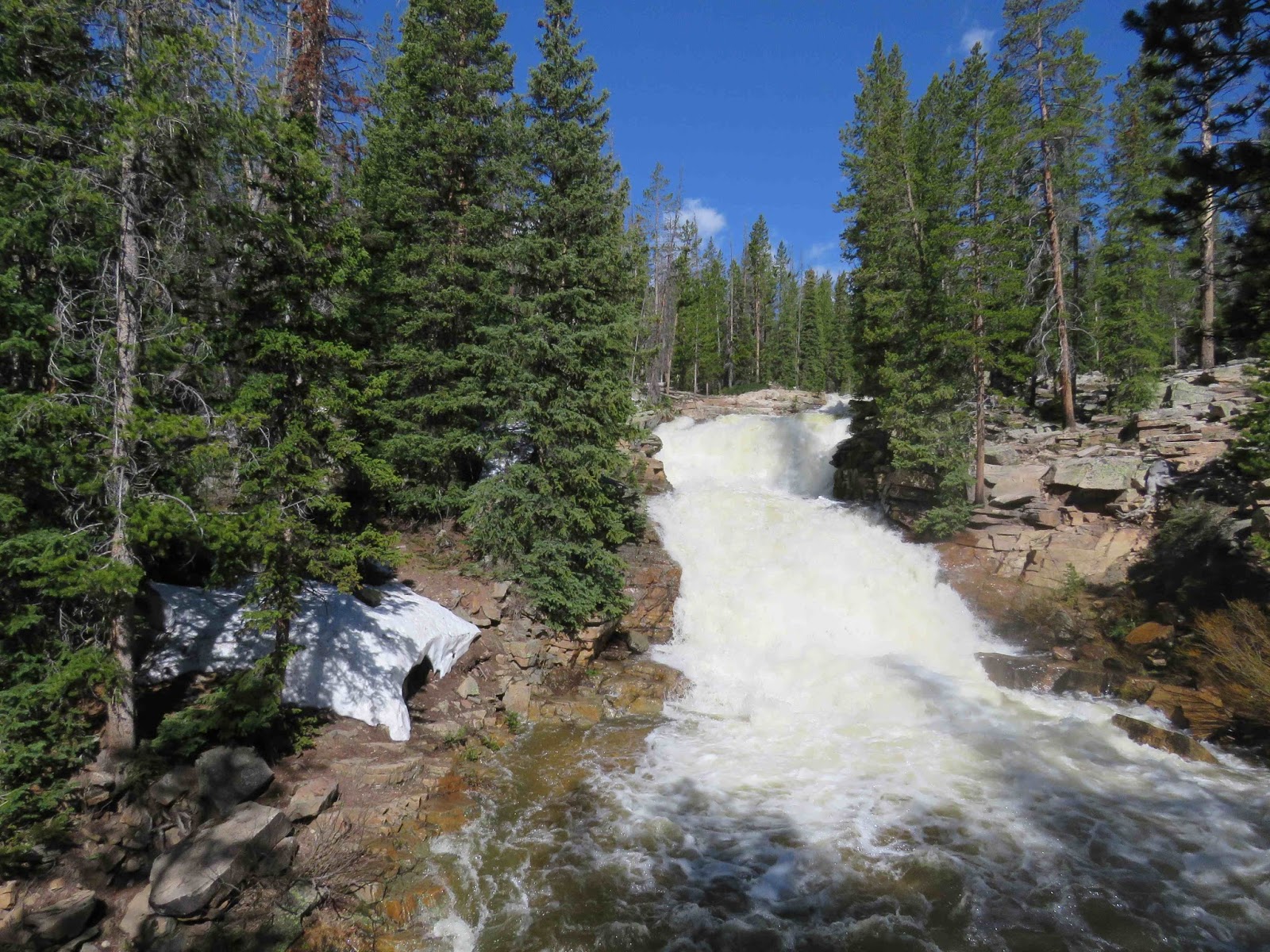
I not sure why I'm surprised with all the snow we've had this winter. Wow!
I head down the trail to check out the two other Falls.

Falls #2.

And Falls #3.

Incredible!!!
Along the trail, I find both Spring Beauty (a lot) and a few Glacier/Avalanche Lilies.
Heading upward, I finally start reaching snow - a little at first but as I get higher -- there's snow everywhere. I pass both Lily and Lost Lakes (the road splits between them) and their wonderfully icy still. Will have to stop on my way back.
Next stop is the main viewpoint just under Bald Mountain Pass (10,700 ft). Not too bad!


Heading down from the Pass, the Fehr Lake parking lot is buried in snow as is Moosehorn Lake. So I'm not surprised to see the turn-off for Mirror Lake to be buried as well. (I am confused my the numerous cars all squished together at the turnoff -- it's going to be a long wait before that wall of snow disappears.)
I continue onto Pass Lake. The usual abundant parking is about 7 spots. There are only 2 cars there so I park. I tromp thru the 2-3 ft of snow (hardpacked) down to the lake. There's a narrow band along the shore that's open (mostly muddy) so I move along to get a good view of the snowy mountains and partially frozen lake.

From there, I continue towards Evanston stopping at a still frozen Butterfly Lake.

Quite a few cars here. I tromped over the snow for a bit -- not sure where all these people went. (Obviously, they are better snow hikers than I.)
Next stop is Ruth Lake at the foot of Hayden Peak (actually on the other side of the road, but the mountain is right there). I decide to take the trail (if I can find it) for a bit -- hoping to at least get a better view of Hayden Peak.
Exciting to see some patches of open ground which means trail -- I just need to connect the open patches. Beautiful quiet woods with plenty of streams flowing thru.

I'm definitely not going to find Ruth Lake on my own with GPS coordinates but I do find my rocky hill that will be my stopping point and hopefully my good view. The hill is pretty much snow-free and covered in Spring Beauty. There's a few Glacier Lilies around.
And I do get my view!!

I make my way back to my car. I could go home now but I decide to continue another 10-15 miles to Christmas Meadow (8700ft) to see if there are any butterflies. It's probably too early but I go anyway.
I do see a deer in one of the wet meadows along the way.
I arrive to lots of wonderful flowers but no butterflies.

I walk around hoping to scare up something but no luck.
Time to head back towards Kamas. I stop at one of those wet meadows on the way back to check out a big puddle (no butterflies).

I stop again at Pass Lake -- missed this view on the way in.

And then tromped thru the snow to get to Moosehorn Lake.


Then the "Old Glory Lookout".

(There's only room for 2 cars to park right now (re: snow) and it was "full" when I first arrived.)
And finally Lily Lake (to the west)

And Lost Lake (to the east)

Awesome day!!