Sunday, November 12, 2017

Nov 9 - Castlewood Canyon

On a quick trip to the Denver area. After my appointment, I still had time to squeeze in a short hike before making my way back to the airport.

Sunny but very cool day (in the 40s). Heading to Castlewood Canyon State Park (6100 ft) for a short hike. The park is about 5 miles south of the town of Franktown (south and a bit east of Denver). I've never been there before (obviously) so this will be fun.

The park is around 2600 acres in the "ecologically unique Black Forest region of Colorado" - lots of Ponderosa Pine.

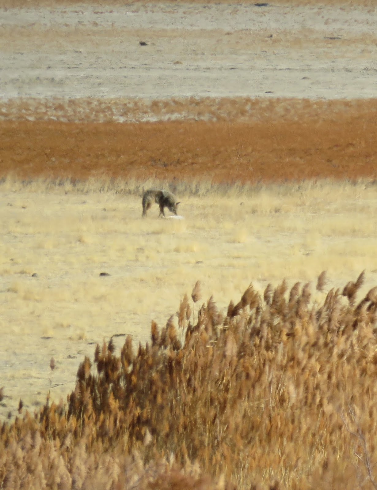
I turn right off the RT83 heading into the park and I immediately see a very large herd of pronghorn just outside the parks boundary in the grasslands. Awesome!!

After watching them for a bit, I head to the gate, pay my admission, drive to the 1st parking lot and start down the Canyon View Nature trail. The "trail" is a concrete sidewalk. A bit disappointing but it does make things more accessible. (I'm sure there are other trails.) As I head down the side walks, there are lots of picnic tables and other sidewalks going in different directions.

I see some low growing cactus, rocks and lots of Ponderosa Pine trees.

Although all the sidewalk branches are a bit confusing, I keep walking in the direction of the canyon and find an overlook.

And then another.  (I can see Cherry Creek below)

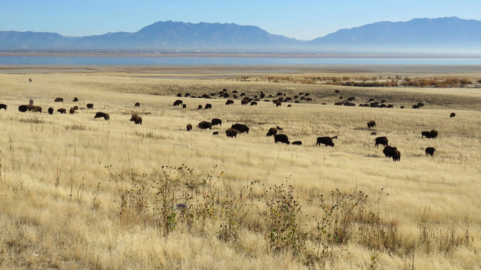
The trail continues but I decide to turn around and head back to my car so I can head to the final parking lot and hopefully some real trails. It's a real short drive to the next parking lot. There I start down the Lake Gulch Trail (0.8 miles). The trail heads in the northerly direction. I reach the Pikes Peak overlook very quickly and take the short detour to the overlook. It's too sunny and hazy to see the Peak - perhaps at sunset. But below is a large grassland with some cows (just small dots).

Pretty quiet - except for the cows mooing.

Continuing on the views of the grassland continue to my left but to my right it gets pretty rocky as the trail drops (about 200 ft) to that grassland. Looks a little like southern UT but much smaller. :)

The trail "ends" at the creek (that runs down the canyon).

I have to cross the creek on some large boulders.

That's the end of the Lake Gulch Trail. Now I can either head back on the Inner Canyon Trail or continue onto the old dam on the aptly names Dam Trail (0.35 miles). I want to see the dam (and I have plenty of time) so I continue on thru up a small hill and continue along the grassland.

The Castlewood Dam was built in the 1890s to contain water for farming and people. No different than today.

On Aug 3, 1933 the dam broke after a multi-day heavy rain event flooding some 34+ miles to Denver. And this is all that remains of the dam.

I can continue up to the remaining portion of the dam or continue below on the Creek Bottom Trail (1.7 miles). Just before I reach the dam, I actually see some wildlife - a Chickadee!

I pass below the dam and continue along the creek.

I'm not heading the entire 1.7 miles (just don't have the time); however, I do want the reach the waterfall (which looks to be around 1 mile down the trail).

I'm now following along the creek.

I'm in the very cool shade now. There's light snow on the trail. This is rattlesnake country (one was seen along this trail on Oct 29) but it's shady and cold, I don't think any snake would be out today.

The creek is visible in spots but mostly it's hidden behind boulders. but it's still very pretty especially the cliff on the other side of the creek.

Soon I see a wooden fence and a big drop-off on the other side. I turn around and there's the waterfall (still flowing!!)

I continue along the trail until it ends just past the falls. (The trail actually continue but there's steps involved.) Time to head back.

Soon I'm back at the start of the Inner Canyon and Lake Gulch Trail. Part of me wants to take the same way back and be in the sun. But I have to complete the loop and head down the Inner Canyon Trail (1.1 miles) along the creek. I'm not sure how I'm going to get across but I trust the map that I will be able to get across.

Lot's of rocks along the trail with good views of the creek. The trail follows the edge of the forest.

Not far down the trail, I see my 2nd bird of the day -- a Brown Creeper (I think).

I expecting my crossover to be wide open as it was on the Nature Trail so I keep looking as I walk. (All forest on the other side.)

Soon I see some wooden fences so I must be close. Surprise! There's a foot bridge to cross the creek.

And a bunch of steps up thru the forest to get back to "street-level". Neat little trail (~4miles).

Time to head to the airport. On the way out, the Pronghorn are gone.

Nice stop!

Monday, November 6, 2017

Nov 5 - Sentry Trail (Antelope Island)

Not a pretty day out as a cold front pass thru bringing snow in the mountains and spotty drizzle in the valley. But I'm heading out to Antelope Island anyway as it is supposed to clear.

It's around 48 degrees when I arrive. The northern part of the island is sunny (since clouds passing thru though) but the southern part is still under dark clouds.

I want stay north in the sun but they're finishing up the annual bison physicals and the corrals are very near the White Rock trail (which I'd be hiking). Since the bison are being released so near the trail, I just don't want to deal with a couple hundred freed bison. Heading south to the clouds and the Sentry Trail.

I pass a couple of bison pretty quickly and a little further down the road see a bunch of bison on top one of the hills - must are laying down.

There's a big herd under the White Rock trail ridge too.

After passing Frary Peak, I see a dark spot near the white Farmington Bay shoreline. At first I think it's a Crow/Raven but it's moving. I zoom in with my camera and it's a coyote!!!

It looks like he's sniffing something on the ground. Then he disappears into the grasses.

Moving on, I pass a couple of smaller bison herd on the way to the Ranch but see no deer or antelope. :( Not too surprised though because I'd guess the animals were forced to move around when they herded the 500 bison to the corrals a week ago.

I park at the Trail Head and start up the trail. Still lots of clouds around but there are peeks of sun.

I don't see any animals as I look around. There's still a few sunflowers in bloom in spots on the trail. Not much moving along the trail other than a single beetle and a small flock of birds.

Oops can't forget the butterfly. Monarch, CA Tortoiseshell or Painted Lady???? I tried unsuccessfully to find it when it landed.

I reach the ridge the water is so calm below.


I track along across the ridge and behind Sentry Peak before starting the trek down.

Along the way, I see 8 Clouded Sulphers, a single dragonfly and a coyote running in the distance.

Time to head back up the island.

Along the causeway I spot for 3 Western Grebes (I think)

Lovely day


Sunday, November 5, 2017

Nov 2 - Twin Lakes (Big Cottonwood Canyon)

Partly cloudy and mid-60s, it's a perfect day for an after work hike....and it will be the last one of the season as the time change this week-end will push darkness to 5:30.

Driving up the canyon, it's conifers and naked trees -- very bare.

When I arrive at Silver Lake, it's 45 degrees and the wind is blowing before our week-end storm comes in.

The peaks, as I walk around the lake, are hard to see due to the elevation/direction of the sun.

The prep for the winter season has begun as the tall orange flags are now present along the boardwalk. Also, I can see what looks like snow making machines on the Brighton slopes.

Crossing the footbridge, I see one fish swimming in the water below.

I head directly to Twin Lakes thru the bare Aspens arriving at the switchback above Twin Lakes.

I carefully look for Pika as I cross - I see two!

I also see a Stellar's Jay flying along the trail.

Up, up to Twin Lakes.

At one point I look up and I see something dark entering the woods. I look in the woods but see nothing -- maybe it was just bird or just the sun in my eyes. A couple of steps further, I see a deer crossing the trail!! I find the other one that crossed before him. (Good I wasn't seeing things!)

A few steps further, I see 2 (no 3) deer on the other side of the trail.

Cool, a herd of 5 deer!

A bit further, I stop 3 on the ridge!!

As I finish the last bit of the uphill section, I see another deer down to the left. Perhaps, she's one I've already seen and it is just moving up the hill or it's another deer.

I arrive at Twin Lakes. (Water levels are still dropping.)

I head down the trail along the lake. I'm not heading all the way to the other end, just the connector where the two lakes meet - that's a little more than 1/2 way down the lake. Lot's of steep beach along the way.

Once there I head off trail to the "beach" and walk down to Lake #2. Along the way, I see many deer tracks in the sand. I stop with Twins Lake Pass to the left of the peak.

Then I head up the beach along the connector.

Stopping on a rock for a short rest.

One more look at the Pass and then it's time to head back.

On the way down, I see no deer but find 3 Pika in the rocks over Silver Lake.

Lovely hike.
 

Saturday, October 28, 2017

Oct 27 - Little Cottonwood Trail (Little Cottonwood Canyon)

Heading out for a quick after work hike today. It's a great day - sunny and around 60 degrees. Looking for something with a chance of color so I decide to head to the mouth of Little Cottonwood Canyon to hike the Little Cottonwood Trail. I've been on this many many times, mostly in the Spring and Winter.

I opt for the shorter hike so I bypass the main lower parking (saves me 2 miles round-trip) for the smaller upper parking. By the looks of the trees along the road, there won't be many leaves to look at today just naked trees - oh well.

I arrive at the upper parking and head down to the trail. There's sun but most of this hike will be in the shade as the trail is near the mountains and the sun so low this time of the year and not making it over the peak down to the trail. Glad I brought my fleece (wish I brought my gloves though).

I head to the left and the end of the trail. Pretty bare trail, no birds singing, and I don't see/hear any critter running around....just the flowing of the stream to listen to.

I do spot a butterfly in a small sunny section. Mostly likely a Comma but I didn't really get a good look.

I arrive at the end of the trail and the old concrete building. The creek is low but flowing.

Time to head downhill to the lower bridge about 2 miles away.

I make a stop at the water wheel (water here)

But not on the other side (from a bridge less than 50 yards away). Siphoned away for our water supply.

Down, down I go until I arrive at the final bridge. A trickle of water flowing here. This is the current state of the waterfall.

Time to head back.

Good little hike.

Thursday, October 26, 2017

Oct 24 - Frary Peak (Antelope Island)

Beautiful sunny day with temps in the mid-60s forecast today.

Part of me really want to head into the mountains but the other part was concerned with the snow/ice I may face so I'm heading to Antelope Island to hike the Frary Peak trail. I've only hiked this once before; it was in the Spring (I remember flowers). Didn't make it up to the top as after the 3 mile mark, the trail appears to turn very rocky - looks sketchy for me. But I still had an awesome view!! That's were I plan on stopping again today.

As I cross the causeway, I see American Avocets

and Shovelers (they're back for the winter).

I arrive on the island and head south towards the Ranch (and Frary Peak).

Not far down the road, there's a lone bison near the road.

A little further (before the gate), there are 3 other bison. One of which has a flower stuck in his horn.

Near the bison are two pronghorn grazing nearby.

I continue down the road, checking the first pullout; no animals below. Moving on the road heads downhill and at the bottom of that hill is a huge herd of bison!!

I continue onto the Frary Peak turn-off and then head up to the parking lot. Only a single car in the lot and I don't see them on the trail nearby.

The trail up Frary Peak is 3.2 miles and a tad over 2000 ft gain to ~6600 ft. (I'm only going 3.0 miles to the radio tower. I guess someday I should just try that last 1/4 mile to the top of Frary Peak instead of judging the trail by looks, but it won't be today.)

It's just 43 degrees and sunny as I start up the trail. And the trail, well, there's no warm up as it climbs 500 ft in less than 3/4 mile.

Happily, it levels off as the trail passes Dooley Knob. Below I can see another herd of bison just to the south of me.

I'm sure I'll see these guys again as I gets viewpoints to the east.

Frary Peak (the tall one) is looking nice this morning.

Before I switch over to the west side of the island, I notice 2 bison (mostly likely males) head butting below me. (I wish I was closer to see and hear the battle.)

The trail then crosses over to the west side of the island heading south towards Frary Peak - Elephant Rock is now in view as it White Rock Bay/Meadow.

The rest of the trail switches between mildly climbing to steep. Most path is mostly on the west side of the island with a few viewpoints looking east.

I pass a rocky outcropping and start hearing Chukkars and I eventually find them.

It's not long before I round a corner and there's a lone bison about 50 yards in front of me.

Not to worry, I turn south following the trail. However, Mr Bison decides to parallel me so I can't leave him alone. I keep walking, he keeps walking. Finally, he stops and start pawing the ground. Oh, he's not happy with me. I wish the trail would veer east or go uphill really soon. After pawing, he lays on the ground and starts wallowing. I don't think that's a good thing (but it's fun to watch).

Finally, the trail goes uphill (yea!)

and thru a rock tunnel

and I can leave Mr Bison behind.

He continues to move but downhill towards Elephant Rock. (Good, I won't have to deal with him later.)

Speaking of Elephant Rock, I finally pass it by.

And watch several bison running through a gully below. (Looks like a herd on the move!)

Back to the east side again; just briefly looking northeast past Dooley Knob.

I continue on. In the distance on the ridge I notice something. It's probably just a rock but I need to check it out.

Well, its not rocks....... they are Bighorn Sheep!!! A whole herd of them! (Probably 11-15 of them)

Pays to check things out!! It's the first time I've seen them here! So I'm pretty excited! And I get to watch them for quite awhile as I heading south and they are south of me. Very cool!

Looks like several males, females and this years babies. I know rutting season is coming soon and it appears the males are sniffing to see if the females are in heat.

I stop several times to take pictures. Even when I finally get parallel to them, they are far away but the camera really helps.

At around the 2.5 mile mark, I finally lose sight of them as a mountain gets in the way. Only 1/2 mile to get to Stringham Peak (6374ft) - one more hill to climb.

On the way up, I meet the folks from the other car in the parking lot. I ask them about the Sheep and they did see them; they crossed the trail in front of them.

There's the radio tower; just a few more feet.

Soon I'm on top with a 360 view of the world!

South towards Frary Peak.

West

North

and East.

Awesome!!!

I find a spot to take a break and have lunch...with the world below me feet.

Time to head down.

On the way, I look for the sheep. It took me a while but I find a bunch of them feeding a bit lower than they were previously. The others might be around and just blending into the landscape or they might have move on.

I continue down catching sight of 2 butterflies. I'm not sure what they are but I did see a flash of orange. A bit further down,, I see another and it's a (surprise) a California Tortoiseshell!!

I never knew they flew here. But then the only times I ever hike is in the Fall, Winter, and Spring (before the biting gnats come out) so that's not prime butterfly season. I guessing those other two were CA Tortoiseshells as well.

I finally have Dooley Knob in view again and White Rock Bay.

Looks like there are a couple of Bison in White Rock Meadow and a whole herd up on Beacon Knob.

I'm finally down at the trailhead were I find a Melissa Blue!!

Incredible day!

On the way back up the island, that large herd of bison is still there. But there are 3 pronghorn to the south of them at the water well.

Can't beat this day!!